Users of social media will have seen a bit of a flurry when Parklands first volunteer-created walking map went live recently on the Walking Maps website.
Walking Maps is a project of Victoria Walks, a charity inspiring more people to walk more every day. Walking Maps helps people to find great walks and create digital walking maps that can include photos, links, and notes of interesting things along the way.
Our first map was created by keen observer of nature Lizette Salmon, and we congratulate Lizette on having her terrific map featured in the Victoria Walks newsletter.
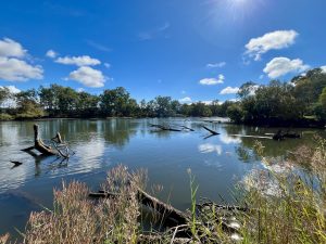
Lizette’s one hour walk on Federation Hill features birds she observed and photographed on her regular walks on the hill. She has recorded sixty bird species on this walk.
The Federation Hill Birding Hotspots walking map is the first in our series of local walks recorded by local people. Featuring the bush parks of Albury Wodonga, the walks will inspire you to get out with your phone and create your own themed map.
Parklands have been working with volunteers through lockdown to learn the art of digital map making using mobile phones, as part of a project supported by the Victorian Government through the Parks Victoria Volunteering Innovation Fund.
For further information contact us at info@parklands-alburywodonga.org.au